Discover the Adventure
Chico Day Trip to Sutter Buttes
Follow Our Day Trip to Sutter Buttes
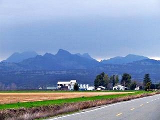
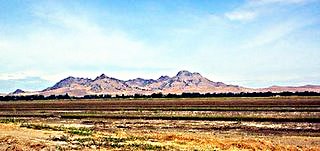
Touted as the Smallest Mountain Range in the World, the Sutter Buttes will not be ignored if you're driving through the Upper Sacramento Valley!
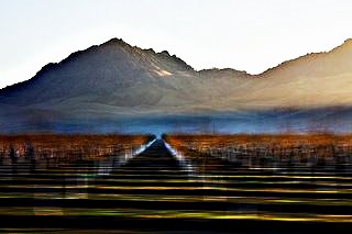
They rise up, seemingly from out of nowhere, right smack in the middle of the surrounding flat farmland, much like the peaks of mountains that rise above the cloud cover when you fly over in an airplane.
Whether you're traveling along Interstate 5 or Highway 99, you'll know the Buttes when you see them, and you'll be able to see them from as far away as Sacramento to the South and Chico to the North.
Do you have a favorite
NorCal story?
From a family visit from years ago to something
you discovered last weekend,
Share it with
the rest of us - we'd love to learn about it!
Find the best prices on Chico area lodging at HotelsCombined.com

Where are Sutter Buttes? For that Matter, What are They?
|
|
Nobody really knows for sure what they are or where they came from, but they have meant many things to many people. To the Valley Indian people - the Maidu, the Buttes are The Middle Mountain, a sacred and spiritual place; the center of the universe where the first Man and the first Woman were created. |
To John Sutter, for whom the Buttes were named in 1949, they were part and parcel of his New Helvetia land grant, back-drop for the Sutter Hock Farm near where Yuba City stands today.
To General John C. Frémont and his ragamuffin group of followers, the Buttes offered a refuge when the Mexican Army got too close.
But the Buttes themselves remain somewhat of a mystery! Situated between the Sierra Nevadas and the Coastal Ranges, they suddenly rise up out of the flat valley floor, looking as much like a castle fortress as a mountain range.
We know they're volcanic in nature because of their deep volcanic roots. We know they're not connected to the Sierras, nor are they associated with the Coastal mountains. Some geologists believe the Buttes may be a disconnected outcrop of the Cascade Range, which is also volcanic, but no one knows for sure.
Regardless of how they came to be, they have fascinated us for as long as mankind has lived in the Upper Sacramento Valley - maybe as long as 10,000 years)!
Visiting Sutter Buttes Today
When you drive North of Sacramento on either Highway 99 or Interstate 5, it isn't long before you spot what almost looks like a mirage, but is actually the world's tiniest mountain range. It dominates the landscape because of its suddenness - it just seems to pop up out of nowhere!
That's one way to see the Buttes; look and wonder as you drive on by. A better way is to take a closer look by circumnavigating a 39-mile loop, from one county road to another, until you have driven (or biked, for you ambitious sorts) the whole way round. This trip will give you a full, 3D look at this circular range that, because of its isolation, has its own unique flora and fauna.
As for actually visiting the Buttes - as in hiking them, this is a complicated topic! Most of the land is privately owned.
In 2003 the State of California acquired property on the North side of the Buttes, (Peace Valley) but they haven't yet designated its classification, nor have they negotiated a right of way with the surrounding ranches.
So there is no public access to what is being loosely referred to as Sutter Buttes State Park. Between privately-owned property and inaccessible public land, you can't just put on your walking shoes and take a hike at the Buttes.
However, all is not lost! Middle Mountain Foundation - the Sutter Buttes Regional Land Trust and a nonprofit organization - provides access to some of the privately-owned regions of Sutter Buttes through their Interpretive Program hikes.
A typical hike starts at 8:30 am, concludes about 3:30 in the afternoon, and is led by a guide who is experienced in the natural ecology of the area and will be able to interpret what you're seeing and answer your questions about the area. See The Middle Mountain Foundation for more information on their hikes.
For lodging in the area, or anywhere in Northern California, check in at HotelsCombined.com to compare pricing and get the best price before you book:

Getting to Sutter Buttes from Chico
To reach the Buttes from Chico, take Highway 99 to the Yuba City area, turning off at Butte House Road.
Follow Butte House to Acacia Avenue (on the North side of the little town of Sutter), turning right on Acacia, then veering left onto Pass Road.
The rest of the circumnavigation trip looks like this:
Turn right on West Butte Road; Turn right on North Butte Road; Turn right on Powell Road; Turn left on Pennington Road; Turn right on Township Road; Turn right on Clark Road; Turn left on East Butte Road; Reconnect with Butte House Road to close the circle
You've now explored the circumference of the Sutter Buttes! And here are some of the things you can look for along the way:
- The Frémont Monument which commemorates the 1846 camping grounds of Frémont and his men, and also gives great views of the interior of the Buttes
- South Butte, the tallest peak in the range
- Goat Rocks
- West Butte
- The Butte Sink Area to the west - one of the largest resting spots for migratory waterfowl along the Pacific Flyway
- The paved road that - could you follow it (it's private property now) - would lead to the former Titan Missile Base
- An easy side trip could take you through Gray Lodge Wildlife Area where you're bound to see migratory or resident waterfowl any time of year
- And be sure to enjoy the ag land along the way - especially the almond orchards!
The best advice we can give you: bring a really good map unless you've done this before! The entire trip (from Chico to Sutter Buttes and back again to Chico) is about 140 miles and takes about 3 1/2 hours (without any stops).
We hope you've enjoyed our little Day Trip to Sutter Buttes! Please come back often as more Chico Day Trips are coming soon! In the meantime, here's another one:
- Gold Country Drive
Relive the Gold Rush with another of our Chico day trips! Historic buildings, hard-rock mining, museums, Old Towns, gold discovery site, gold panning...
Please continue your exploration of what Northern California has to offer by using the Nav Bars in the left and right columns or by using the links at the bottom of the page.
Like what you're finding here at Discovering Northern California? Then please share with the Social Network of your choice.
And thanks for coming!
Related Articles
Chico Day Trips
Chico Day Trips
Gold Country Drive
Lake Shasta Caverns
Sutter Buttes Drive
Related Articles
Day Trips
Introduction
Big Sur Day Trips
Chico Day Trips
Sonoma Day Trips
Related Articles
Chico, California
Chico
Day Trips
Downtown
Events & Festivals
Farmers Markets
Things To Do
Related Articles
Butte County
Butte County
Chico
Day Trips
Downtown Chico
Events & Festivals
Farmers Markets
Things to Do
Related Articles
Shasta Cascade
Butte County
Modoc County
Shasta County
Siskiyou County
Tehama County
Trinity County
Related Pages
Hints & Tips
Beach Safety Tips
Best Kept Travel Secrets
Family Camping Tips
iPhone Travel Apps
Nude Beaches
Tide Pool Tips
Travel Sites We Love
Travel Tips
Whale Watching Tips
Wine Tasting Tips
Winter Driving Tips
Related Pages
Things To Do
Activity Village
Attractions
Beaches
Beer Lovers Delight
Burney Falls
Camping
Casa de Fruta
Day Trips
Gold Panning
Gold Rush Sites
Healdsburg
Historic Grass Valley
Lake Shasta Caverns
Lodi
Missions
Nevada City
RV Destinations
Ski Resorts
Tide Pool Tips
Travel Tips
Weekend Trips
Whale Watching
Wine Tasting
Related Pages
Free Things To Do
Free in Big Sur
Free in Chico
Free in San Francisco
Free in Sonoma
Related Pages
Insider Secrets
Best Kept Travel Secrets
Best Winter Whitewater
Boring Road? Nope
CA Admission Day
Climbing at Castle Rock
Crabbing Spots
Dream of Dreams
Fall in Eastern Sierras
Ghost Stories
Glass Beach
Great Stays, Low Pays
How to be a Valley Girl
Jade Beach
Lake Shasta Caverns
Lassen Volcanic SP
Lost Coast
Mono Lake
Moss Landing: Whales
New Clairvaux Abbey
Panning for Gold
Pygmy Forest
Mendo to Eureka
RV Destinations
SF Great Places to Eat
SF: More About Eating
SF Neighborhoods
SF Giants Baseball
Santa Cruz: Memories
Santa Cruz: Old Friends
Sonoma Cooking Class
Sonoma History
Sonoma Top Wine Stop
Tahoe: Discovery Trail
Underground Gardens
Yosemite: Family Hikes
Yosemite: High Country
YNP: Off the Beaten Path
Yosemite: Taft Point
Ziplines


